-
-
The Maps Viewer is installed on all VMs
-
Book a virtual image processing machine
-
-
Open the virtual image processing machine
-
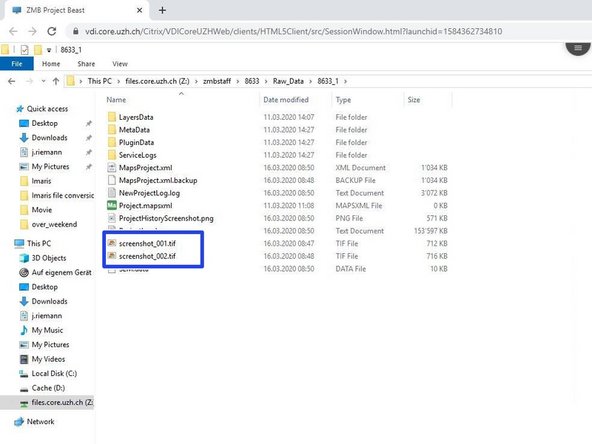
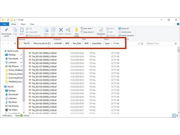
Go to your project to the folder Raw_Data
-
choose your experiment number and open the folder
-
Open the project with a double mouse click on Project.mapsxml
-
-
-
If this warning appears always click on "Update History"
-
-
-
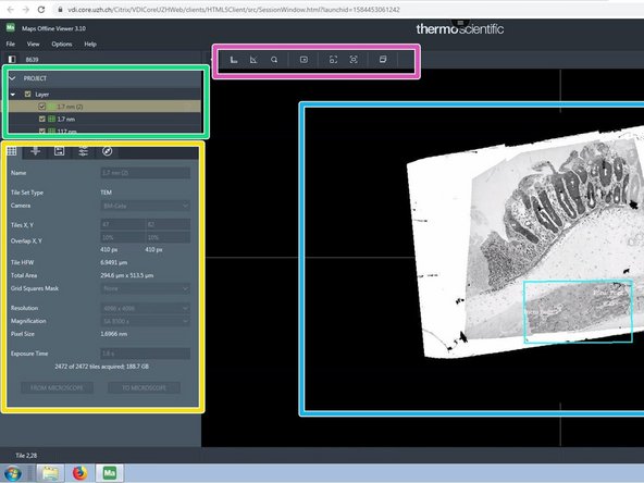
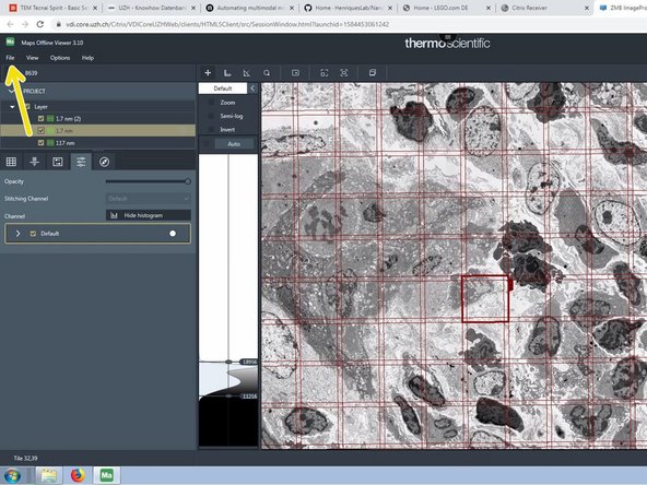
Data area organized in layers and tilesets. The active objects are highlighted.
-
Imaging settings organized in different tabs.
-
Tools
-
Viewer
-
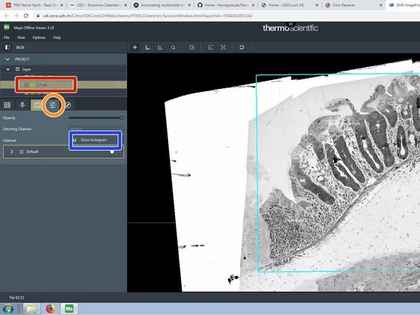
choose the tileset you want to adjust
-
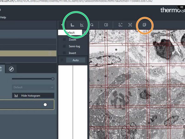
Click on the Tab "visualization"
-
"Show histogram"
-
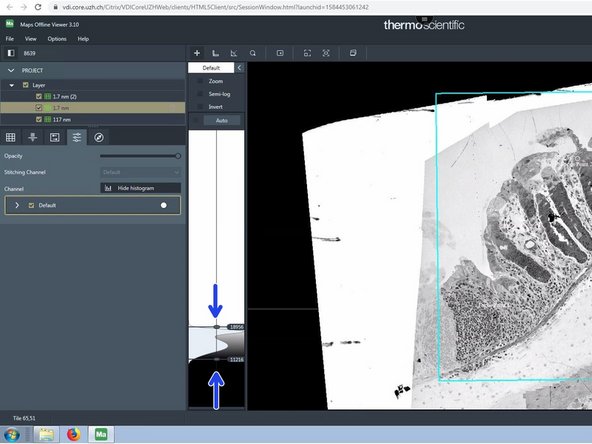
adjust the upper and the lower threshold for the histogram
-
-
-
Navigate intuitively in your data
-
Annotate regions of interest
-
-
-
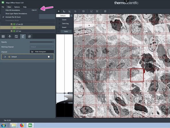
Go to "View", "hide all annotations" to hide the grid bars and annotations.
-
This can also be done with the Keyboard shortcut Ctrl + h
-
These tools measure distances and angles
-
Use this tool to make screenshots
-
The screenshots are saved in the Maps project base folder
-
-
-
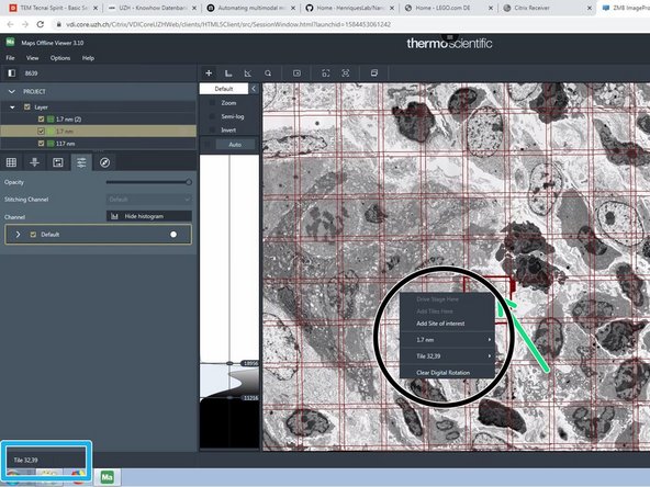
Click on a single tile in a tileset.
-
In the lower left corner the tile coordinate/ name is shown.
-
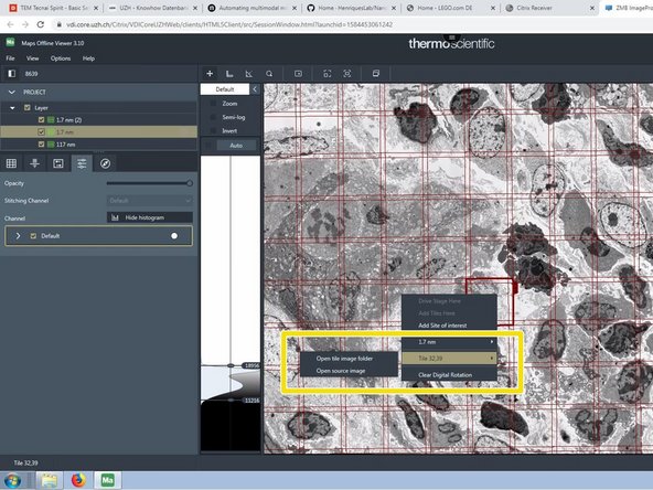
Right click on the tile to get more options.
-
Go for the tile and choose the option " open tile image folder, if you want access to the raw data.
-
The file explorer opens the folder with the raw .tif images.
-
-
-
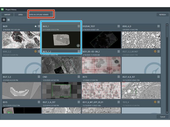
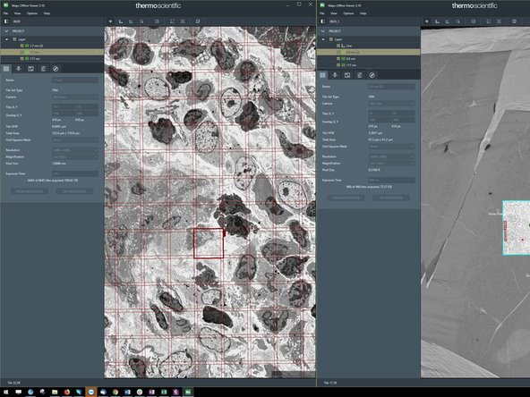
Maps can only open projects in a second window, that have already been opened before.
-
Go to "FIle" -> "open"
-
Choose a second project from the list of projects, that you opened before
-
Choose open in offline Viewer
-
Maps opens a second window with the chosen project
-
-
-
The program can be closed without saving. Every change is automatically saved.
-